![]()
Title: Decoding Earth’s Subaqueous Secrets: Fresh Discoveries from the Gofar Transform Fault
Working as a geophysicist often resembles the role of a detective—unearthing enigmatic clues hidden deep beneath the Earth’s crust to create a more illuminated understanding of the forces that shape our dynamic planet. A pioneering new study, featured in Science Advances and spearheaded by experts at the Woods Hole Oceanographic Institution (WHOI), has unveiled some of the most intriguing insights into the enigmatic mechanics of oceanic transform faults.
Revealing Mysteries from the Depths
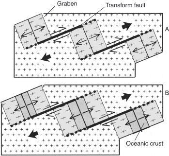
In a joint effort funded by the National Science Foundation, researchers concentrated on the Gofar transform fault. Found on the Pacific seafloor, this underwater fault zone is similar to the well-known San Andreas Fault in California, as it accommodates the lateral, shearing movement of tectonic plates. However, Gofar’s characteristics have captivated scientists for another reason: it experiences substantial, predictable earthquakes approximately every five to six years, a consistency that makes it an excellent site for examining the mechanisms and causes behind earthquakes.
Although seismic data—recordings of earthquake vibrations—have disclosed considerable information about this fault’s mechanical behavior, researchers sought to explore further. To accomplish this, they employed an unconventional instrument in the geophysicist’s toolkit: electromagnetic (EM) imaging.
Through EM data, scientists can visualize the electrical conductivity of materials beneath the surface. This is particularly important in oceanic settings because salty seawater exhibits significantly higher electrical conductivity than adjacent rock. Consequently, by mapping variations in EM signals, researchers can deduce where water or other conductive substances may be located below the seafloor.
Unveiling Conductive “Blobs”
Utilizing this method at the Gofar fault, scientists produced the most comprehensive image to date of an oceanic transform fault’s subsurface electrical characteristics. Their findings were unexpected: highly conductive “blobs” positioned beneath one side of the fault—anomalies that contradicted prevailing geological theories.
“We were astonished to observe such a pronounced difference across the fault,” stated Christine Chesley, a postdoctoral researcher at WHOI and the primary author of the study. “The structure of conductivity contradicted all our preconceptions regarding oceanic transform faults.”
Interestingly, these conductive areas did not appear in other forms of geophysical data like seismic imaging. This prompted researchers to embark on a scientific investigation to clarify this mystery.
The Brine and Magma Link
Cracking the code involved understanding which materials could generate such high EM conductivity. Following thorough examination, the team inferred that these “blobs” were likely accumulations of brine—highly saline water—entombed beneath the fault zone’s crust. And where brine exists, there’s commonly a heat source. In this scenario, the researchers suspect that magma may be lurking nearby.
“We believe this heat source is magma situated close to the transform fault,” Chesley remarked. “This is surprising since transform faults were traditionally not thought to facilitate magmatic or hydrothermal activities.”
Rob Evans, a senior scientist at WHOI and co-author of the study, pointed out that conventional models of transform faults depict them as rather straightforward, inactive zones when compared to more thoroughly studied boundaries like mid-ocean ridges or subduction zones.
“This image and the data derived from it challenge our perceptions of these faults. It indicates that even the least explored boundaries may possess hidden complexities,” emphasized Evans.
Transform Faults Under a Fresh Perspective
Oceanic transform faults, alongside divergent and convergent plates, constitute the trio of tectonic boundaries on our planet. In contrast to the volcanic activity seen in convergent zones or the spreading centers of mid-ocean ridges, transform faults have long appeared sedate—essentially regarded as dry, stationary fissures sliding past one another. The insights gathered from Gofar disrupt this assumption, indicating not only the presence of concealed fluids but also thermal activity potentially fueled by magma.
Such revelations do more than transform scientific comprehension; they carry significant ramifications for global hazard assessments and the foundational dynamics of Earth’s crust. How do water and heat impact earthquake prediction? Why do certain sections of the fault exhibit greater fluid richness or magmatic activity than others? What exists just beyond the capabilities of current imaging technologies?
Prospective Research on the Horizon
The authors of the study are advocating for further investigations to determine how these newly uncovered features interact with the larger geological systems of the area, including the adjacent mid-ocean ridge system.
“We possess this incredible image of this specific segment of the Gofar fault,” Evans mentioned. “However, we have yet to grasp how it links to the neighboring mid-ocean ridge. We are optimistic that additional funding for the project will bolster further exploration.”
Institutions contributing to this tectonic enigma comprise not only WHOI but also the University of Delaware, Boise State, Scripps Institution of Oceanography, MIT-WHOI Joint Program, University of New Hampshire, among others.
Conclusion: The Investigative Journey Continues