🌍 Launch of Biomass Satellite Initiates a New Chapter for Climate Science and Forest Surveillance
On April 29, 2024, the European Space Agency (ESA) reached a pivotal milestone in climate research with the triumphant deployment of its highly anticipated Biomass satellite. Taking off from Europe’s Spaceport in Kourou, French Guiana aboard a Vega-C rocket at 11:15 CET, the mission is heralded by scientists as the onset of a new “forest space age.” With advanced radar technology aimed at quantifying forest biomass or “woody carbon,” this satellite is set to transform the methodologies researchers use to observe forests and monitor carbon emissions on a global scale.
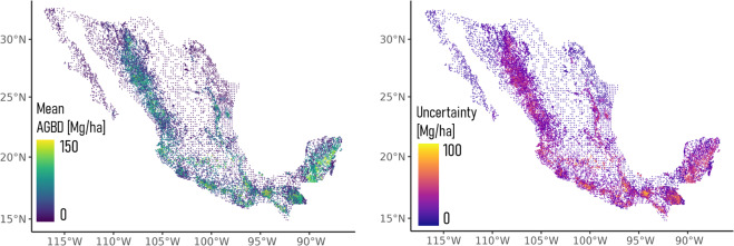
A Satellite-Based Instrument to “Measure” the Global Forests
Equipped with an innovative P-band synthetic aperture radar (SAR), Biomass is the first of its kind to be launched into orbit. Operating at roughly 70 centimeters in wavelength, this radar can penetrate even the densest tropical forest canopies. Unlike conventional optical sensors and radars with shorter wavelengths that often bounce off treetops, Biomass’s P-band radar can peer through the leaves and branches to assess the volume and structure of trunks and stems—the key carbon reservoirs in forest ecosystems.
But why does this matter so much? Up to this point, researchers have faced challenges obtaining comprehensive and reliable data regarding carbon storage in the world’s forests. Forests play a vital role in regulating the climate, absorbing approximately 8 billion tonnes of carbon dioxide each year. Nonetheless, this essential function is jeopardized by deforestation, degradation, and climate change. The loss of forests not only signifies fewer trees but also results in substantial amounts of sequestered carbon being released, thus accelerating global warming.
“Biomass now becomes part of our distinguished collection of Earth Explorers — missions that have consistently unveiled groundbreaking insights and enhanced our scientific understanding of the planet,” remarked Simonetta Cheli, ESA’s Director of Earth Observation Programmes. “With Biomass, we are on the verge of acquiring crucial new information on the carbon storage in Earth’s forests, aiding in closing major knowledge gaps in the carbon cycle and, ultimately, the global climate system.”
Years in Development
Though Biomass stands as a technological wonder today, its development spans more than two decades. Professor Lars Ulander from Chalmers University of Technology was among the first to suggest the concept to ESA. His aspiration was simple yet ambitious: to comprehend how forests interact with the climate and to assess how environmental changes impact them.
At an altitude of 666 kilometers and circling the Earth every 98 minutes, Biomass will produce global forest maps during its five-year primary mission. It will deliver consistent data on forest structure and dynamics—information essential for enhancing climate models, verifying carbon accounting for international climate pacts, and bolstering conservation policies.
The 12-meter-wide deployable radar reflector, supported by a 7.5-meter boom, is now being activated as part of Biomass’s “launch and early orbit” phase. Once fully extended and calibrated, the satellite will become operational and continuously monitor the planet’s forests across all latitudes.
A Collaborative Effort Between Space and Ground-Based Science
Despite Biomass’s remarkable capabilities, scientists emphasize that satellites alone cannot provide the complete picture. “Even the most advanced satellite cannot distinguish a mahogany tree from a Brazil nut tree without ground assistance,” stated Professor Oliver Phillips from the University of Leeds.
To ensure the data gathered from space is precise and impactful, researchers are combining on-the-ground observational initiatives through efforts like GEO-TREES. This international collaboration unites forestry experts, ecologists, and remote sensing specialists to conduct detailed, ground-level measurements of trees. These readings are critical for calibrating and validating Biomass’s radar data.
“The objective of GEO-TREES is to establish a sustainable funding framework to support ecologists and experts in the forest who will take the necessary tree-by-tree measurements to verify satellite data products,” explained Klaus Scipal, ESA’s Biomass Mission Manager.
Supporting Global Climate Initiatives
High-quality information on forest biomass and carbon reserves is invaluable for policymakers and climate negotiators. The work of Biomass will assist in evaluating the effectiveness of climate action initiatives like REDD+ (Reducing Emissions from Deforestation and Forest Degradation) and furnish nations with scientifically robust data for carbon accounting in relation to the Paris Agreement on climate change.
By providing continuous, comprehensive measurements of aboveground biomass, the satellite will further enable habitat monitoring, biodiversity research, and sustainable forest management—an exemplary illustration of how space technology directly contributes to enhancing environmental policy on Earth.
A New Era for Earth Observation
Biomass transcends being merely a satellite; it symbolizes the fusion of decades of scientific aspiration, European engineering brilliance, and an urgent global necessity for reliable climate data. As it ascends into orbit, it embodies humanity’s escalating ability to comprehend and safeguard the ecosystems that sustain life.
In orbit not just for science, but for the future.