This is the fourthin a series of discussion of selected parts of Paul Strathern’s The Other Renaissance: From Copernicus to Shakespeare, (Atlantic Books, 2023). For more general details on both the author and his book see the first post in this series.

Strathern introduces us to today’s subjects thus:
We now come to two figures who used ingenious mathematical techniques to unravel their own versions of the truth. These were Gerardus Mercator and François Viète, both of whom lived exciting lives (though not always pleasantly so), and whose works would play a part in transforming the world in which we live.
Although Mercator’s biography is well documented Strathern still manages to screw up his facts. He tells us that his father was from Gangelt and was therefore German. Gangelt was at this time in the Duchy of Jülich and the inhabitants spoke a dialect of what would become Dutch. I do wish people would look more deeply at nationality, ethnicity etc in history, just because somewhere is German or whatever today doesn’t mean it was in the sixteenth century. Then he tells us:
During Mercator’s youth, two historic events took place which would change Europe forever. Mercator was just five when Luther instigated what would become the Reformation, and he was ten years old when the survivors of Magellan’s three-year expedition to circumnavigate the globe arrived back in Seville. By this time young Mercator’s father had died, and his uncle had taken on the role of his guardian.

Mercator was actually fifteen when his father died, and his uncle placed him in the school of the Brethren of the Common Life in ‘s-Hertogenbosch. Here Strathern drops a paragraph that brought tears to my eyes the first time I read it, not really believing what I had just read. The second time through I started weeping and the third time I just wanted to burn the whole thing down.
Even so, the main curriculum was still based on the traditional scholastic trivium of grammar, logic and rhetoric, all of which were of course taught in Latin. However, in a gesture towards the renaissance of classical knowledge, the curriculum had been extended to include Ptolemy and his Geography. The Ancient Greek polymath had written this work in Alexandria around AD 150. The fact that it was written in Ancient Greek meant that it had remained unknown to Europe during the medieval era, as scholars only knew Latin. It was not translated until 1406, when its appearance created a great stir. Meanwhile Ptolemy’s geocentric cosmology, which Aristotle had passed on, would not be refuted by Copernicus until 1543, when Mercator was in his thirties. But much of Ptolemy’s Geography, especially his map of the world – consisting of a chart which stretched from the Atlantic coast in the west to Sinae (China) in the east – had come as a revelation to the young Mercator.
Ptolemy’s Mathēmatikē Syntaxis (Almagest) and his Tetrabiblos were available and widely read in Latin in the medieval period, both of them having translated directly from the original Greek in the twelfth century, but apparently his Geōgraphikḕ Hyphḗgēsis (Geographia) was not as, “it was written in Ancient Greek meant that it had remained unknown to Europe during the medieval era, as scholars only knew Latin.” This is of course total bullshit. There was no Latin translation of the Geographia in Europe in the Middle Ages because there was neither a Greek nor an Arabic manuscript of the work known before a Greek manuscript was discovered in Constantinople in the early fifteenth century and translated by Jacobus Angelus in 1406.
Meanwhile Ptolemy’s geocentric cosmology, which Aristotle had passed on [my emphasis], would not be refuted by Copernicus until 1543, when Mercator was in his thirties.
Please savour this gem of a sentence, you will probably search high and low to find its equivalent in stupidity in a supposedly serious, ‘academic’ publication. Strathern claims to be an academic author. Aristotle (384–322 BCE) passed on the geocentric cosmology of Ptolemy, written c. 150 CE!
Having imbibed Ptolemaic geography at school, Mercator now goes off to university:
In 1530, at the age of eighteen, Mercator travelled to the similarly prestigious University of Leuven. Here he passed the entry matriculation, where his name appears in the Latin form he had adopted at school followed by the classification pauperes ex castro (poor students of the castle). This indicated that he was given lodgings in one of the communal dormitories set aside for unprivileged students in the castle by the fish market. Rich students lived separately in their own rooms in a more salubrious quarter of the city.
Pauperes does in fact mean that he was a poor student but ex castro refers to the college he was in Castle College (Dutch: De Burcht or Het Kasteel, Latin: Paedagogium Castri) the oldest of the Leuven colleges, founded in 1431. All the students, rich or poor, lived in the same college building, although the quality of their rooms varied.
Strathern now slips in a reference to Vesalius:
Despite such domestic segregation, all students mingled freely, attending the same lectures, and it was here that Mercator formed a friendship with one of his more privileged contemporaries, named Andreas Vesalius, of whom we will hear more later. Suffice to say that Vesalius would become one of the great luminaries of the northern Renaissance, on a par with Mercator himself, with whom he retained a lifelong friendship.
Although they almost certainly knew each other, I know of no special friendship between Mercator and Vesalius. However, there was one between Vesalius and Gemma Frisius, about whom more soon, they even, infamously, stole part of a corpse on a gibbet together.
Having graduated MA in 1532, Mercator took himself off to Antwerp for two years, rather than progressing on to one of the higher faculties to study, theology, law, or medicine. During these two years, he took up contact with Franciscus Monachus, (c. 1490 – 1565), a Minorite friar at the monastery in Mechelen, who had earlier taught geography at the University of Leuven. Strathern introduces Monachus thus:
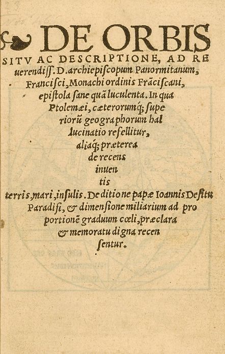
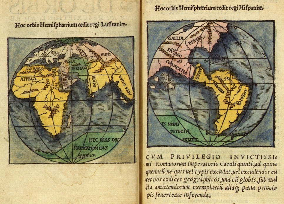
As we have seen, in 1494 Pope Alexander VI had brokered the Treaty of Tordesillas, which aimed to avert a dangerous clash between the two Catholic countries most involved in exploration – namely, Portugal and Spain. The pope had drawn a line north–south through the middle of the Atlantic Ocean: all land discovered to the west of this line (i.e. the New World) would belong to Spain, while all land discovered to the east of it (Africa and Asia) would belong to Portugal. Illustrating this ruling, as well as making allowances for consequent discoveries, Monachus drew two circular maps. One depicted the western hemisphere of the Americas, and the other outlined the eastern hemisphere: Africa, India and the lands to the east, which he named Alta India (in effect ‘Beyond India’). In the light of Magellan’s circumnavigation, the next obvious step was to create a model of the world in the form of a globe.
His globe, which did not survive, came first, and was constructed with the engraver Gaspard van der Heyden(c. 1496 – c. 1549). The two hemispherical maps are in an open letter describing the globe to his patron, Jean II Carondelet (1469–1545), Archbishop of Palermo, entitled De Orbis Situ ac descriptione ad Reverendiss. D. archiepiscopum Panormitanum, Francisci, Monachi ordinis Franciscani, epistola sane qua luculenta. (A very exquisite letter from Francis, a monk of the Franciscan order, to the most reverend Archbishop of Palermo, touching the site and description of the globe) in 1524.
Strathern now launches into a brief history of terrestrial globe-making, of which I will only give extracts that mostly need correcting:
Monachus was not the first to do this. Indeed, in line with the rebirth of classical knowledge, it was known that the Ancient Greek philosopher Crates of Mallus (now south-east Turkey) had produced a globe as early as the second century BC.
Nothing to criticise here but Strathern then goes into a discussion in which he states:
This illustrated Crates’s belief that the world consisted of five distinct climactic zones.
The climate zones or climata are, of course, standard Greek cosmography and predate Crates. First hypothesised by Parmenides and then modified by Aristotle. We move on:
A rather more accurate representation appeared during the Arab Golden Age, when in 1267 the Persian astronomer Jamal al-Din travelled to Beijing and created a terrestrial globe for Kublai Khan.
Jamal al-Din didn’t create a terrestrial globe for Kublai Khan in Beijing. When he travelled to Beijing, to become head of the Islamic Astronomical Bureau he took seven astronomical instruments of Islamic type with him, namely an armillary sphere, a parallactic ruler, an instrument for determining the time of the equinoxes, a mural quadrant, a celestial and a terrestrial globe, and an astrolabe with him.
Just prior to the geographical revolution which had taken place during Mercator’s childhood, the German navigator, merchant and map-maker Martin Behaim constructed the Erdapfel (earth apple), the earliest-known surviving globe, which followed the prevailing ideas held by Columbus, omitting any large land mass between western Europe and China.
Martin Behaim was not a navigator.
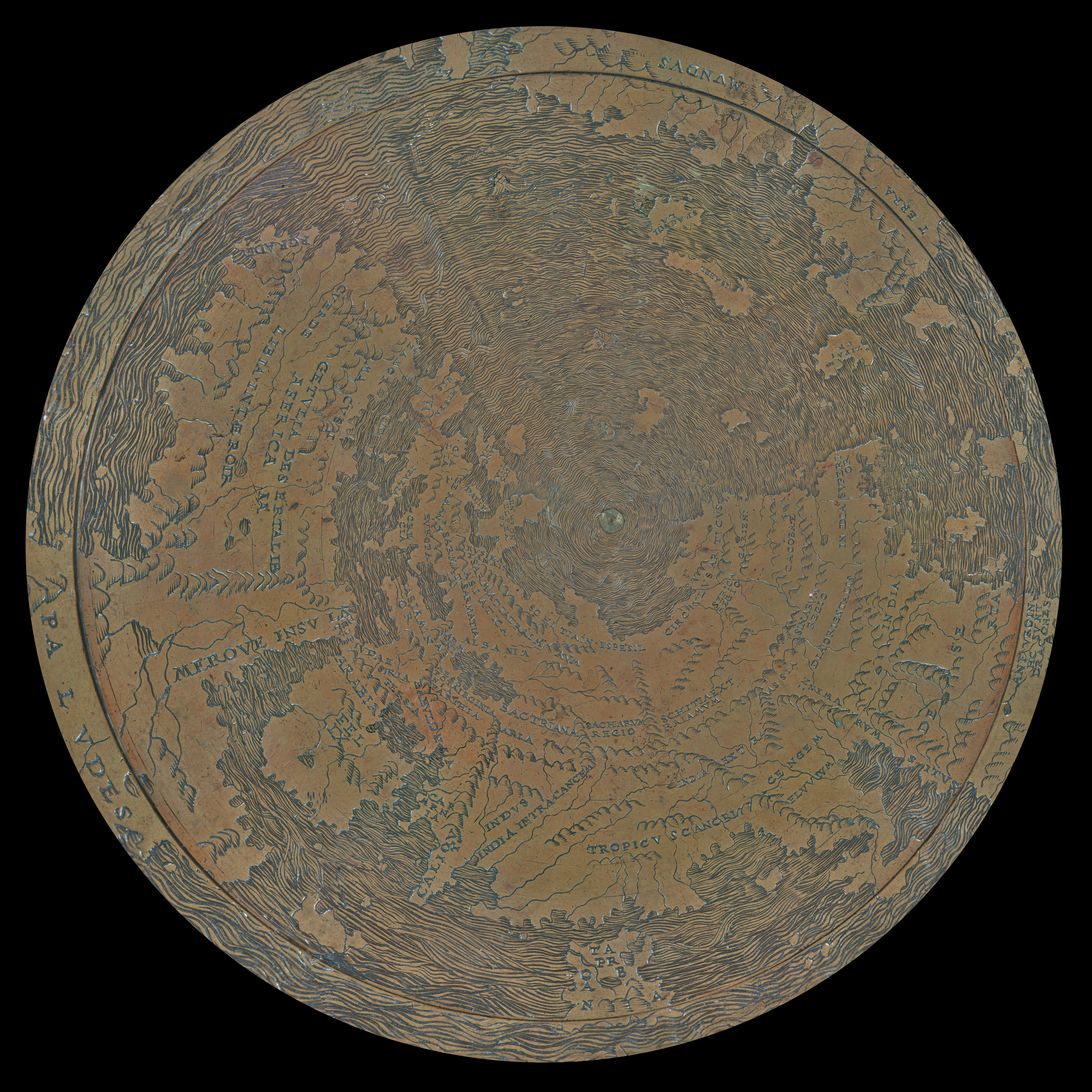
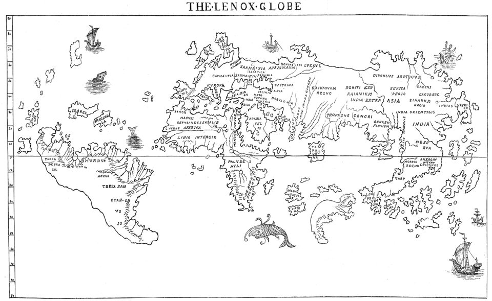
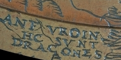
This appeared in 1492, and over the coming years it inspired a number of more accurate globes. One, constructed out of two glued-together lower halves of an ostrich egg, was among the first to include the New World. Another, cast in copper, imitated medieval maps which illustrated undiscovered regions with dragons, monsters or mythical beasts. It also labelled the unknown region to the south of China Hic sunt dracones (Here be dragons), which would become a popular appellation covering unknown regions in later maps.
Both the provenance of the Ostrich Egg Globe and its supposed date (1604) are, to say the least, disputed and I would not include it in any serious account of the history of globes.

The copper globe, that it is very similar to, is the Lenox Globe (1610) and its undiscovered regions are not illustrated with dragons, monsters, or mythical beasts. It is in fact only one of two maps known to bear the legend HC SVNT DRACONES (Latin: hic sunt dracones means here are dragons), the other is the Ostrich Egg Globe.

The handful of globes that Strathern has mentioned in his brief survey are all so-called manuscript globes i.e., they are handmade unique examples. Strathern makes no mention whatsoever of the most important development in globe history, a very significant one for Mercator, the advent of the printed globe. The earliest known printed globe, of which only sets of gores exist, was the small globe printed of the Waldseemüller world map that gave America its name.

This globe was relatively insignificant is the history of the globe, the major breakthrough came with the work of the Nürnberger mathematicus, Johannes Schöner (1477–1547). Schöner went into serial production of a terrestrial globe in 1515 and a matching celestial globe in 1517.

In the 1530s he produced a new updated pair of globes. We will return to Schöner and the influence of his globes on Mercator.
But first back to Strathern:
However, the most significant feature of these globes for Mercator was that, unlike with previous medieval maps, their geographical features were drawn or painted upon solid round surfaces. A map on a globe represented the actual size and shape of its geographical features, whereas a continuous map on a flat rectangular chart was bound to distort shapes, stretching them the further they were from the Equator [my emphasis]. The understanding of this fundamental distinction would be the making of Mercator.
That all flat maps distort was well-known to Ptolemy, who in his Geographia explicitly states that a globe is the best representation of the world. To transfer the map from the globe to a flat map one needs a projection, Ptolemy describes three different ones, and each projection, of which there are numerous, distorts differently. Strathern seems to imply here that there is only one map projection and the distortion that he describes here is that of the Mercator projection!
But first of all he [Mercator] would have to understand the complexities of maps and globes.
These he learned from a curious character by the name of Gemma Frisius…
[…]
Although only four years older than Mercator, at this stage he may well have taught Mercator mathematics.

Why is Gemma Frisius (1508–1555) a curious character? Strathern gives no explanation for this statement. There is also no ‘may well’ about it, when Mercator returned to Leuven in 1534 after his two-year time-out, he spent two years studying geography, mathematics, and astronomy under Gemma Frisius’ guidance. He also in this period learnt the basics of instrument and globe making from Frisius. Strathern now delivers up a very garbled and historically highly inaccurate account of how Frisius and Mercator became globe makers.
Around 1530, when Frisius was in his early twenties, a local goldsmith called Gaspar van der Heyden produced ‘an ingenious all-in-one terrestrial/celestial globe’. This incorporated a geographical map of the world, on which were also inscribed the main stars of the heavens. Such was the complexity of this muddled enterprise that it required a three-part booklet to explain how to understand it. The task of writing this was assigned to Frisius, and its title gives an indication of the difficulties involved: On the Principles of Astronomy and Cosmography, with Instruction for the Use of Globes and Information on the World and on Islands and Other Places Recently Discovered.
What actually happened is somewhat more complex. Schöner had become a highly successful globe maker and his globes were being sold over all in Europe. However, there was a greater demand than he could supply.
Jean II Carondelet, the Archbishop of Palermo, who as we saw above was Franciscus Monachus’ patron and dedicatee of his De Orbis Situ, commissioned the Antwerp printer/publisher Roeland Bollaert, who had printed the De Orbis Situ, to reprint Schöner’s Appendices in opusculum Globi Astriferi, in 1527, and the engraver Gaspard van der Heyden was commissioned to engrave the celestial globe to accompany it. In 1529, Gemma Frisius edited an improved second edition of Peter Apian’s Cosmographia, which was printed and published by Roeland Bollaert. Gemma Frisius, who had earlier studied under Monarchus, began to work together with Gaspar van der Heyden, and it was Gemma Frisius who created the ‘ingenious all-in-one terrestrial/celestial globe’, which van der Heyden engraved. Gemma wrote the accompanying booklet Gemma Phrysius de Principiis Astronomiae & Cosmographiae deque usu globi ab eodem editi (1530), which was published by the Antwerp publisher Johannes Graheus. It is probably that Roeland Bollaert had died in the meantime. In this book Gemma Frisius acknowledges his debt to Johannes Schöner. Monarchus had also acknowledged his debt to both Schöner and Peter Apian in his De Orbis Situ. Gemma Frisius and van der Heyden later produced a new pair of globes, 1536, terrestrial and 1537, celestial, and this time Mercator was employed to add the cartouches in italic script to the globes, his introduction to globe making.
Strathern now tells us about Gemma Frisius’ book and its influence on Mercator:
Within this cornucopia of often extraneous knowledge were to be found the sound principles which Frisius would later pass on to Mercator. Most importantly, these involved such vital cartographic elements as the principles of longitude and latitude, which form a network covering the surface of the globe. The lines of longitude are drawn down the surface of the globe at regular intervals from the North Pole to the South Pole.* As long as a ‘meridian’ or middle point (line zero) is established, it is possible to record how far one’s position lies east or west of this line from pole to pole. By this time, navigators were beginning to carry shipboard clocks. As a rough-and-ready method for discovering how far east (or west) they had travelled from their home port, they could measure the time discrepancy between noon on the shipboard clock (i.e. noon at their home port) and noon at their current location (the sun’s zenith).
* Both of these were of course theoretical concepts at the time, conjectured from the fact that a globe must have a top (northernmost point) and a bottom (southernmost point.) It would be some five centuries before the existence of the actual poles was confirmed by discovery.
The lines of latitude are drawn around the globe, beginning at its widest girth (the Equator), and then ascending in regular diminishing circles towards the North Pole, and also descending at regular intervals to the South Pole. In order to establish their longitude, navigators had learned to measure the precise location above the horizon of stars in the sky. This also could be compared to their location when at the home port. Such measurements were taken with an astrolabe (literally ‘star taker’), the forerunner of the sextant.
Reading these atrocious paragraphs, I asked myself why do I bother? Why don’t I just throw the whole thing in the next trash can and walk quietly away? However, being a glutton for punishment, I persevere. But where to begin? I will start with the origins of the longitude and latitude system, at the same time dealing with the mind bogglingly stupid starred footnote.
Most people don’t realise but the longitude and latitude system of cartographical location was first developed in astronomy to map the skies. In the northern hemisphere, if you look up into the night sky, the heavens appear to form a sphere around the Earth and there are stars that every night circle the same point in the heavens, that point is the astronomical north pole. In fact, as we now know it’s the Earth that turns not those circumpolar stars, but for our mapping purpose that is irrelevant. The astronomical or celestial north pole is of course directly above the terrestrial north pole, on a straight line perpendicular to the plane of the equator. You can observe the same phenomenon in the southern hemisphere, defining the south celestial and terrestrial poles, but as the European astronomers could not see the heavens further south than the Tropic of Capricorn, that doesn’t need to concern us at the moment. Note the north and south poles are not theoretical concepts but real points on both the celestial and terrestrial spheres. The lines of longitude are the theoretical great circles around the celestial sphere passing through the north and south poles. The annual path of the Sun defines the Equator and the Tropics of Cancer and Capricorn, the principal lines of latitude. The Poles, the Equator, and the two Tropics are the principal features on the armillary sphere, the earliest three-dimensional model of the celestial sphere created by astronomers, sometime around the third century BCE.

At some point somebody had the clever idea of shrinking this handy mapping network down from the celestial sphere on to the terrestrial sphere, the Earth. The first cartographer to use longitude and latitude for terrestrial maps was probably Eratosthenes (C. 276–c. 195 BCE). His prime meridian (line of longitude) passed throughAlexandria and Rhodes, while his parallels (lines of latitude) were not regularly spaced, but passed through known locations, often at the expense of being straight lines. (Duane W. Roller, Eratosthenes Geography, Princeton University Press, 2010 pp. 25–26). Hipparchus (c. 190–c. 120 BCE) was already using the same system that we use today. Ptolemy, of course, used the longitude and latitude system in his Geographia, in fact a large part of the book consists of tables of longitude and latitude from hundreds of places from which it is possible to reconstruct maps. If as Strathern claims, Mercator studied the Geographia at school then he didn’t need Gemma Frisius to explain longitude and latitude to him.
Strathern’s “By this time, navigators were beginning to carry shipboard clocks. As a rough-and-ready method for discovering how far east (or west) they had travelled from their home port, they could measure the time discrepancy between noon on the shipboard clock (i.e. noon at their home port) and noon at their current location (the sun’s zenith) can only be described as a historical cluster fuck! Dave Sobel’s Longitude (Walker & Company, 1995), for all its errors, and it has many, which tells the story of how John Harrison (1693–1776) produced the first marine chronometer, that is a clock accurate and reliable enough under testing condition to enable the determination of longitude, his C4 in 1761, was almost certainly the biggest popular history of science best-seller ever! Apparently, Strathern has never heard of it!
The whole is much, much worse when you know that the first person to hypothesise the determination of longitude using an accurate mechanical clock was Gemma Frisius and he did so in Chapter nine of his On the Principles of Astronomy and Cosmography, the only one of his publications that Strathern mentions:
… it is with the help of these clocks and the following methods that longitude is found. … observe exactly the time at the place from which we are making our journey. … When we have completed a journey … wait until the hand of our clock exactly touches the point of an hour and, at the same moment by means of an astrolabe… find out the time of the place we now find ourselves. … In this way I would be able to find the longitude of places, even if I was dragged off unawares across a thousand miles.
Gemma Frisius was, however, of the difficulties that the construction of such a clock would involve:
… it must be a very finely made clock which does not vary with change of air.
More than a hundred years later the French astronomer Jean-Baptiste Morin (1583–1656), who propagated the lunars method of determining longitude wrote:
I do not know if the Devil will succeed in making a longitude timekeeper but it is folly for man to try
Strathern is not much better on latitude, The lines of latitude are drawn around the globe, beginning at its widest girth (the Equator), and then ascending in regular diminishing circles towards the North Pole, and also descending at regular intervals to the South Pole. In order to establish their longitude [sic, I assume that should read latitude!] navigators had learned to measure the precise location above the horizon of stars in the sky. This also could be compared to their location when at the home port. Such measurements were taken with an astrolabe (literally ‘star taker’), the forerunner of the sextant. Latitude is determined by measuring either the height of the Sun, during the day, or the Pole Star, at night. That’s why in marine slang the daytime measurement is called “shooting” the sun. As David King is fond of repeating, the astrolabe was never used for navigation. It is possible that fifteenth century navigators used a mariner’s astrolabe, but more likely that they used a quadrant or a Jacob’s staff. Frisius’ lifetime is too early for the backstaff, which was first described by John Davis (c.1550–1605) in his The Seaman’s Secrets in 1594. It is the backstaff that was the forerunner of the sextant not the astrolabe.

The errors continue:
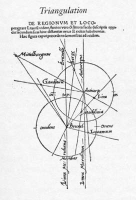
In order to prepare the maps for incorporation on the globe, they first had to be copied to a uniform scale so that they could be aligned with other maps. All this required a sophisticated understanding of the maps involved, and required the use of geometry, trigonometry and especially triangulation.
This last method enabled the map-makers to calculate the precise location of a distant geographical feature – such as a mountain, town or river mouth – using the known location of two other features. The modern version of this method was invented by Frisius in 1533, and worked as follows. First a line of known length was drawn between two features (Brussels and Antwerp in Frisius’s early experiment). Then the surveyor would draw a line from each end of the known line directly towards the unlocated feature (Middelberg, in Frisius’s case) and measure the angles between these lines and the ends of the known line. This gave him a triangle with a base of known length, and two base angles. From these it was a simple matter of geometry to ‘triangulate’ the distances to and position of the unlocated feature.
Gemma Frisius was indeed the first to describe triangulation in the third edition of Apian’s Cosmographia in 1533 but Strathern’s account of how it works is arse backwards. Triangulation is a trigonometrical method of surveying, which is then used to draw maps. First you have to accurately measure your baseline on the ground, in Gemma Frisius’ example between Brussels and Antwerp. Then from the two endpoints the angles of observation of a third point, Middelburg in Gemma’s example, are measured enabling the completion of the triangle on the drawing board and thus the determination of the distances between the endpoints of the baseline and the third point using trigonometry. Gemma Frisius’ example is purely theoretical as you can’t actually see Middelburg from either Brussels or Antwerp.
Strathern devotes some time to Mercator’s biography, his setting up as an independent cartographer and instrument maker and his marriage, then delivers the next piece of history of cartography ignorance:
A year later, in 1538, he produced his first etched map of the world, Orbis Imago. This map is highly ingenious in its representation of the globe on a flat surface. The map is in two parts, which join at a tangent. The first part views the world from above the North Pole, the second from above the South Pole. But instead of showing two semicircles, each view is a rounded heart-shape with an indentation curving in towards the pole. This tearing-apart of the semicircle enabled Mercator to represent the land masses without the distorted exaggeration which would have occurred if the maps had stretched to contain two semicircles. A cut-out of these two-dimensional shapes can be twisted and folded into a semblance of a three-dimensional globe, and there is no doubt that Mercator had something similar in mind. When presented in this form, a flat map of the world did not distort the land masses; however, it also did not provide an accurate picture of the distances between various geographical features so was of little use to mariners.
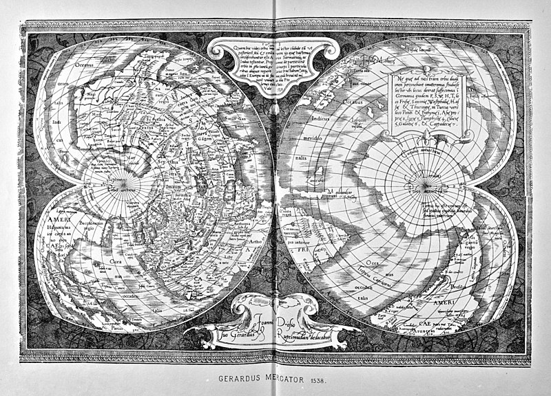
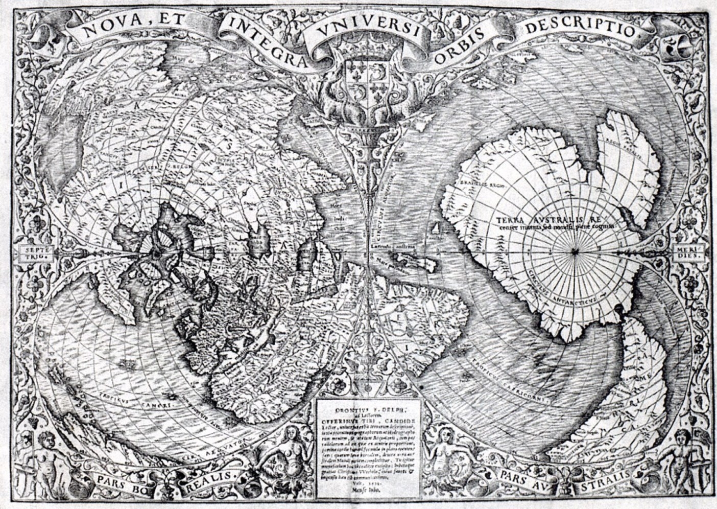
Mercator’s Orbis Imago is a double cordiform (heart shaped) polar projection and Strathern seems to think that Mercator invented it, he didn’t. The cordiform projection is also known as the Stab-Werner projection named after Johannes Stabius (1540–1522), who invented it and Johannes Werner (1468–1522), who first published/publicised it, in his partial translation of Ptolemy’s Geographia (1514). The two mathematici were friends, who knew each other from their mutual time at the University of Ingolstadt. Both Peter Apian in 1530 and the French mathematicus Oronce Fine (1494–1555) in 1531 produced single cordiform projection world maps, of which Mercator was almost certainly aware as the sixteenth century, European, cartography scene was strongly networked.

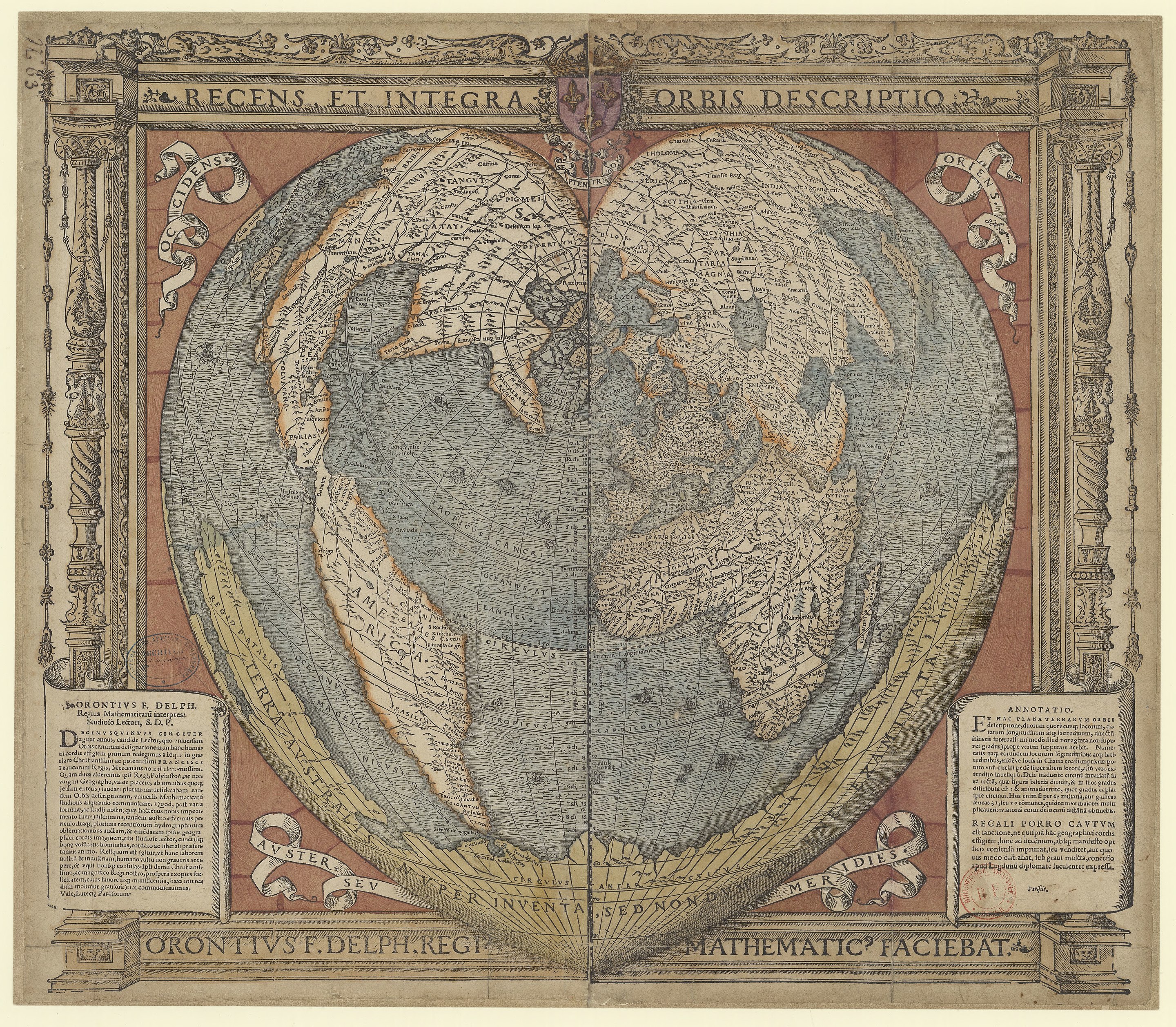
More importantly in 1532 Oronce Fine also produced a double cordiform polar projection world map and Mercator’s Orbis Imago is fairly obviously merely an improved version of Fine’s map.
The Stab-Werner projection is Equal-area i.e., area measure is conserved everywhere and Equidistant i.e., all distances from one (or two) points are correct. It was never intended for use by mariners.
Apart from its geometric ingenuity, Mercator’s Orbis Imago has two other features of note. The view over the South Pole includes a large-scale representation of Antarctica, which he named Terra Australis Incognita (Unknown Southern Land). According to historical records, neither Australia nor Antarctica had yet been discovered by Europeans; however, the existence of such a land mass had long been a theoretical supposition – considered a necessary counterbalance to the land masses of the northern hemisphere.
The Terra Australis Incognita first appeared in the sixteenth century on the globes of Johannes Schöner and it has been shown that Oronce Fine took the details for his maps from Schöner’s work and that Mercator took his from Fine.
Mercator’s map also included the word ‘America’ as a name for the large land mass to the west of Europe.
The German map-maker Martin Waldseemüller had been the first to use the name ‘America’ on a map, in 1507. This labelled a large island, straddling the Equator, which he had named after Amerigo Vespucci, the Florentine explorer whose voyages had provided extensive mapping of the south-east coast of this territory which Vespucci first named the New World.
However, in later maps new evidence had led Waldseemüller to take a more tentative view of Vespucci’s claims, and he replaced ‘America’ with the inscription ‘Terra Incognita’, suggesting that the Terra de Cuba discovered by Columbus was in fact an eastern part of Asia. Mercator’s labelling of America, as well as his clear outlining of the northern and southern parts of this landmass, confirmed once and for all this name.
Both Johannes Schöner and Peter Apian had followed Martin Waldseemüller in his misnaming of the newly discovered continent America after Vespucci, and both continued to do so after Waldseemüller has realised his error and withdrawn the name, which had nothing to do with his believing that Cuba was an eastern part of Asia, so the name had become fixed long before Mercator got involved. However, it was in fact Mercator who first applied the name America to North America.
There now follows a long biographical section that I won’t comment on; I’m only here for the history of cartography. We now arrive at the ominous 1569 world map, and what is probably the worst account of the Mercator projection that I have ever read.
From now on Mercator buried himself in his work. His ambition was no less than to produce a complete map of the world which could be used by navigators.
Throughout history, large-scale maps had usually been centred upon a known location. For instance, Ptolemy’s map was centred on the Mediterranean. Later maps, such as the large round medieval Mappa Mundi,* had Jerusalem as their centre, with the known world radiating outwards from this central holy point. Mercator decided that his map would have no centre. Instead it would be projected onto a grid of longitude and latitude lines – which would become known as Mercator’s projection. On a globe these lines are curved, but on Mercator’s flat surface they were rectilinear straight lines. This inevitably stretched the scale of the map the further it moved from the Equator. For instance, on Mercator’s map the Scandinavian peninsula appeared to be three times the size of the Indian subcontinent, whereas in fact India is one and a half times larger than Scandinavia. But this would in no way hamper navigation, which relied upon location established by lines of latitude and longitude. A ship could sail across an ocean following a constant compass bearing. This may have appeared curved on Mercator’s flat map, but owing to the bulge of the globe it did in fact represent the most direct route.
Ptolemy’s world map in not centred on the Mediterranean; the Mediterranean lies in the top half of the map on the lefthand side.

The starred footnote to “the large round medieval Mappa Mundi,” “*This remains on public display at Hereford Cathedral in England,” seems very strongly to imply that Strathern thinks there was only ever one large round medieval Mappa Mundi, which is of course total rubbish.
Mercator’s infamous 1596 map is centred on the Atlantic Ocean setting a standard for European world maps that would lead to the cartographers being accused of politically portraying the world from a Eurocentric standpoint.
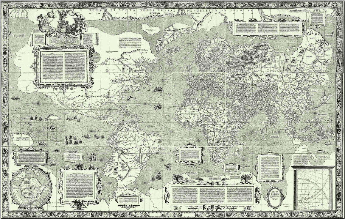
Projecting a map on to a grid of longitude and latitude lines is not the Mercator projection. The printed Ptolemaic world maps of the late fifteenth century are projected on to a grid of longitude and latitude lines (see above), as are the world maps of John Ruysch (1507), Martin Waldseemüller (1507), Francesco Rosseli (1508), Dürer-Stabius (1515), Peter Apian (1530) and Oronce Fine (1536) all on various map projections.
On a globe these lines are curved, but on Mercator’s flat surface they were rectilinear straight lines. This inevitably stretched the scale of the map the further it moved from the Equator.
This is rubbish! In order to have a map on which a loxodrome or rhomb line is a straight-line Mercator systematically widened the distance between the lines of latitude towards the north and south poles, according to a set mathematical formular, which he didn’t reveal. Strathern makes no mention of Pedro Nunes (1520–1578), who first determined the rhumb line as the course of constant bearing on a globe was a spiral, the basis of Mercator’s work. Mercator had drawn rhumb line spirals on his globe from 1541.
A ship could sail across an ocean following a constant compass bearing. This may have appeared curved on Mercator’s flat map, but owing to the bulge of the globe it did in fact represent the most direct route.
Once again Strathern is spouting rubbish. As already stated above on the Mercator projection a course of constant compass bearing, the rhumb line, is a straight-line, the whole point of the projection, and it does not represent the most direct route. The most direct route is the arc of the great circle of the globe that passes through the point of departure and the destination. However, to sail such a course means having to constantly change the compass bearing, so although longer the course of constant compass bearing is easier to navigate.

Yet what happened when a ship travelled beyond the edge of the map? If a ship set sail from China, heading east across the Pacific Ocean, it would soon reach the limit. But if the navigator rolled the map into a cylinder, with the eastern edge of the map attached to the western edge, the solution to this problem was obvious. The navigator could simply continue from the eastern border of the map across the Pacific to the west coast of America. In this he would also be aided by corresponding map references on lines of longitude and latitude.
This is simply cringe worthy. If someone was sailing from China across the Pacific to the west coast of America, they would use a chart of the Pacific for the voyage.
From now on navigators would adopt Mercator’s projection, both for continental and for local charts. The entire world had become ‘orientated’. Originally this word meant ‘aligned to the east’; on Mercator’s projection the world was aligned north, south, east and west, by means of longitude and latitude. And any point on this flattened globe could be pinpointed, as if on a graph, by reading off its precise position in numbers along the lines of longitude and latitude. Dangerous shoals, rocks, river mouths, cities and towns, mountains, borders and even entire countries could be mapped and ‘orientated’. Mercator completed his task in 1569, and to this day Mercator’s projection is how we envisage the world when it is mapped onto a flat surface.
Nobody adopted the Mercator projection in 1569 because Mercator did not explain how to construct it. It first came into use at the end of the century when Edward Wright (1581–1626) revealed the mathematics of the Mercator projection in his Certaine Errors in Navigation (1599). Even then the take up of the Mercator projection for marine charts was a slow process only really becoming general in the early eighteenth century. Strathern still seems to be under the illusion that the cartographical longitude and latitude grid somehow originated with Mercator, whereas by the time Mercator created his 1569 world map it had been in use for about eighteen centuries. The Mercator projection is only one of numerous ways that we envisage the world when it is mapped onto a flat surface and there is in fact a major debate which projection should be used. The use of alongitude and latitude grid does not necessarily imply that a map has to have north at the top.
But Mercator’s task was not complete. For the next twenty-six years he painstakingly created more than a hundred maps, all scaled according to his projection. During the final years of his life he started binding these together with the intention of making them into a book. For the front cover he planned to have an engraving of the Ancient Greek Titan named Atlas, kneeling, with the world balanced on his shoulders. Hence the name which would come to be attached to such compilations of maps.
Mercator did not start binding his maps together with the intention of making them into a book during the final years of his life. His Atlas was part of a major complex publishing project, beginning in 1564, when he began compiling his Chronologia, which was first published in 1569:
The first element was the Chronologia, a list of all significant events since the beginning of the world compiled from his literal reading of the Bible and no less than 123 other authors of genealogies and histories of every empire that had ever existed. (Wikipedia)
The Chronologia developed into an even wider project, the Cosmographia, a description of the whole Universe. Mercator’s outline was (1) the creation of the world; (2) the description of the heavens (astronomy and astrology); (3) the description of the earth comprising modern geography, the geography of Ptolemy and the geography of the ancients; (4) genealogy and history of the states; and (5) chronology. Of these the chronology had already been accomplished, the account of the creation and the modern maps would appear in the atlas of 1595, his edition of Ptolemy appeared in 1578 but the ancient geography and the description of the heavens never appeared. (Wikipedia)
The maps, that would eventually appear posthumously in his Atlas, were not drawn using the Mercator projection, which is totally unsuitable for normal regional maps. The Atlas was not named after the Titan, who carried the world on his shoulders, but after a mythical king of Mauretania credited with creating the first globe, who Mercator described in the preface to his 1589 map collection, “Italiae, Sclavoniae, Grecia”, thus “I have set this man Atlas, so notable for his erudition, humaneness, and wisdom as a model for my imitation.” The name Atlas was first used on the 1595 posthumous map collection Atlas Sive Cosmographicae Meditationes de Fabrica Mundi et Fabricati Figura, published by his son Rumold Mercator (1541–199). King Atlas was first replaced on the cover by the Titan Atlas in later edition in the seventeenth century.
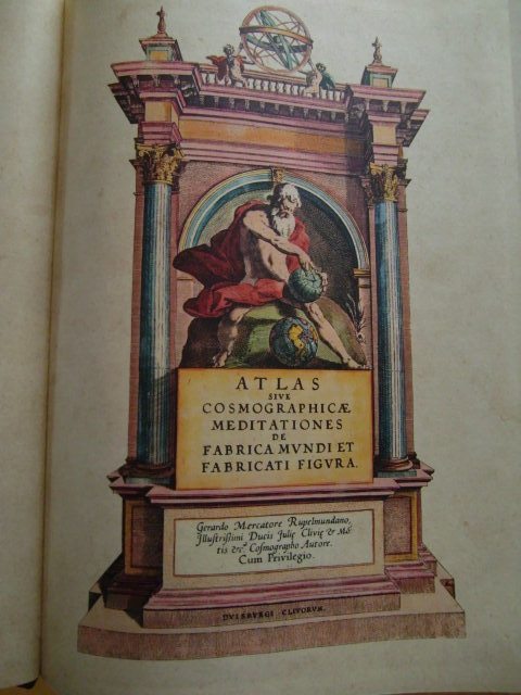
Showing King Atlas of Mauretania
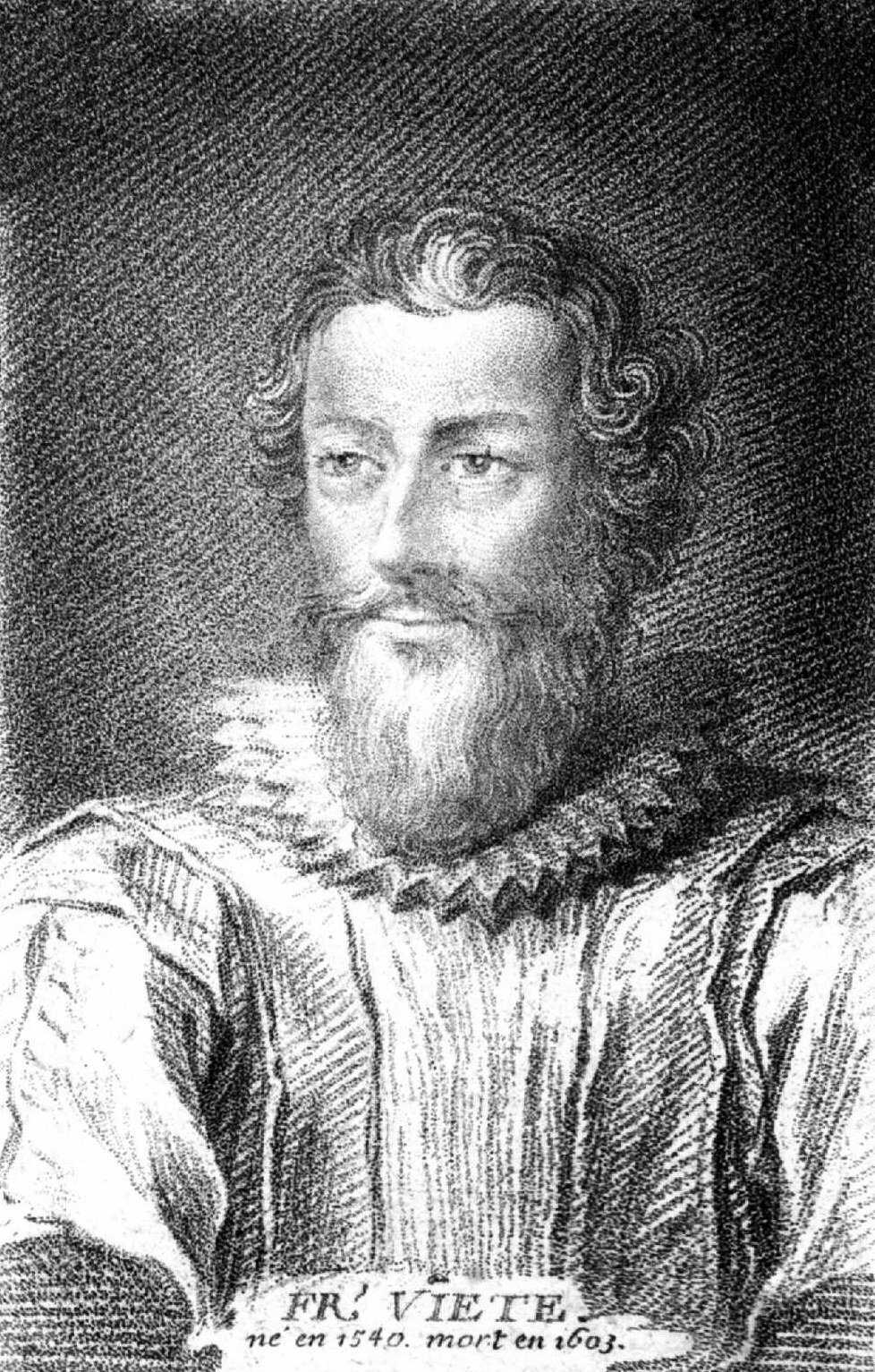
Having royally screwed up the life and work of Mercator, Strathern now turns to the French jurist and mathematician François Viète (1540–1603).
Having started Viète’s biography Strathern delivers this gem:
In 1564, Viète’s mathematical skills led to him entering the service of the Parthenay family, so that he could act as tutor to the twelve-year-old mathematical prodigy Catherine de Parthenay. Together they wrote a number of treatises on astronomy and trigonometry. In these, Viète used decimal notation several decades before this was introduced to the northern Renaissance by the Dutch mathematician Simon Stevin.
Decimal notation had been in use for a couple of centuries before Viète came along, what he tried to introduce without success was the use of decimal fractions.
After lots more biographical detail covering Viète’s political involvements, we get the following.
Viète had become involved in a dispute over the new calendar with the Jesuit monk Christopher Clavius, who had been charged with overseeing its compilation. Such was the subtlety of Viète’s mathematical argument that it was not until more than twenty years later (after his death) that a flaw was discovered in Viète’s calculations.
The Jesuits are an apostolic and not a monastic order, so Christoph Clavius is not a monk. Clavius was not charged with compiling the Gregorian Calendar, but with explicating and defending it after it had been introduced. Viète attacked both the new calendar and Clavius in a series of pamphlets in 1600, in particular the calculation of the lunar cycle. He gave a new timetable, which Clavius refuted, after Viète’s death, in his Explicatio in 1603. I don’t know but in my world from 1600 to 1603 is not twenty years.
What is more surprising is that, during the course of his hectic royal employment, he managed to produce a body of transformative mathematics. In this, Viète attempted to give algebra a foundation as rigid as that of the geometry of Euclid, whose theorems were built upon a number of self-evident axioms.
Viète did try to give algebra a new foundation but the analogy with Euclid’s Elements is badly chosen. The Elements, with its axiomatic approach, is the epitome of the synthetic proof methodology in mathematics. What Viète started was on the way to setting up algebra as the epitome of the analytical proof methodology; in fact, it was Viète, who replaced the term algebra with the term analysis.
At the same time he advocated the viewing of geometry in a more algebraic fashion. Instead of the necessarily inexact measurement with a ruler of lines, curves and figures drawn on paper, these were to be reduced to algebraic formulas, thus enabling them to be calculated in algebraic fashion, giving precise numerical answers.
This is a misrepresentation of what Viète actually did. He revived the geometric algebra that can be found in Euclid’s Elements. Here problems and theorems that we would present algebraically are handled as geometrical constructions. This is the reason why in our terminology x2 is referred to as x squared and an equation with x2 is a quadratic equation. For Euclid x is literally the side of a square or quadrate and x2 is its area. Similarly, x3 is the volume of a cube of side length x, hence the terms x cubed and cubic equation. Viète took this route because he wanted to demonstrate that the variables in an algebraic expression could represent geometrical objects, such as a line segment, and not just numbers. He didn’t develop these thoughts very far.
As we have seen, in the previous century Regiomontanus had attempted a similar standardization of algebra – but this had not become widely accepted.
As I have explained in an earlier post Regiomontanus did not attempt a similar standardization of algebra.
Now Viète would attempt his own fundamental transformation of algebra. This branch of mathematics still largely consisted of a number of algorithms: rules of thumb to be followed in order to find the answer to a calculation. These had been set down in prose form – as indeed had all algebraic formulas. For instance: ‘In order to obtain the cubic power, multiply the unknown by its quadratic power.’ In modern notation, this can be simply put:
y x y2 = y3
Unfortunately Viète was hampered by the lack of an agreed symbol for ‘equals’ (=), as well as agreed symbols for ‘multiplication’ (x) and ‘division’ (÷) – which had also hampered acceptance of Regiomontanus’s notation. However, although Viète’s attempt to rationalize algebraic notation failed to gain widespread acceptance, it made many realize that such reform was long overdue.
The transformation of algebra from rhetorical algebra, in which everything is expressed purely in words, to symbolic algebra, in which symbols are used to express almost everything, had been taking place step for step for a couple of centuries, in the form of syncopated algebra which uses a mixture of words, abbreviations, and symbols in its expressions, before Viète made his contribution As is mostly the case in the evolution of science this was not a smooth linear progress but often a case of two steps forward and one step back. With his In artem analyticem isagoge (Introduction to the art of analysis) in 1591, Viète made a significant and important contribution to that progress. His major contribution was the introduction of letters, vowels, such as A, for variables and consonants, such as Z, for parameters in algebraic expressions. Strathern is correct is saying that Viète lacked symbols for some operators. Interestingly our equals sign, =, had been in use in Northern Italy for some time and had famously been introduced into Northern Europe by Robert Recorde (c. 1512–1558) in his Whetstone of Witte in 1557.

Viète actually managed a ‘one step back’ in his Isagoge. In an earlier step in syncopated algebra quadrate had been abbreviated to q and cube to c, so A2 was written Aq and A3 as Ac. A later development was to drop the abbreviation and write A2 as AA and A3 as AAA, an important step towards our use of superscripts to indicate the multiplicity of a variable. Viète reverted to using the abbreviations q and c. His Isagoge found quite a high level of acceptance; Regiomontanus’ notation, however, found no acceptance because it never existed!
More ambitiously, Viète pressed ahead with his attempt to unite algebra and geometry, though here too any general answer eluded him. But Viète’s efforts were not to be in vain. The very fact that he had attempted such innovations would reinforce the movement of maths in the direction of its modern incarnation, where solutions to both these problems would be found.
Waffle!
It would be the following century when Descartes managed to solve such problems, with the introduction of Cartesian coordinates: two lines at right angles, one representing the x-axis and the other the y-axis. Here the answers to an algebraic formula could be transformed into a line on a graph; likewise geometric lines could be seen as algebraic formulas.
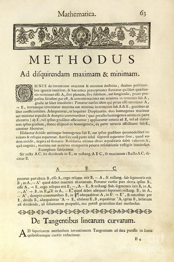
Here we are talking about the creation of analytical geometry, which was developed independently, but contemporaneously, by both Pierre Fermat (1607–1665) and René Descartes (1596–1650). Fermat, who was according to his own account influenced by Viète, circulated his Methodus ad disquirendam maximam et minimam et de tangentibus linearum curvarum, based on work from 1629, in manuscript from 1636, although it was first published, posthumously in 1679. It was less influential in analytical geometry, Descartes having garnered the laurels, but had an important influence on the development of calculus, as acknowledged by Newton.
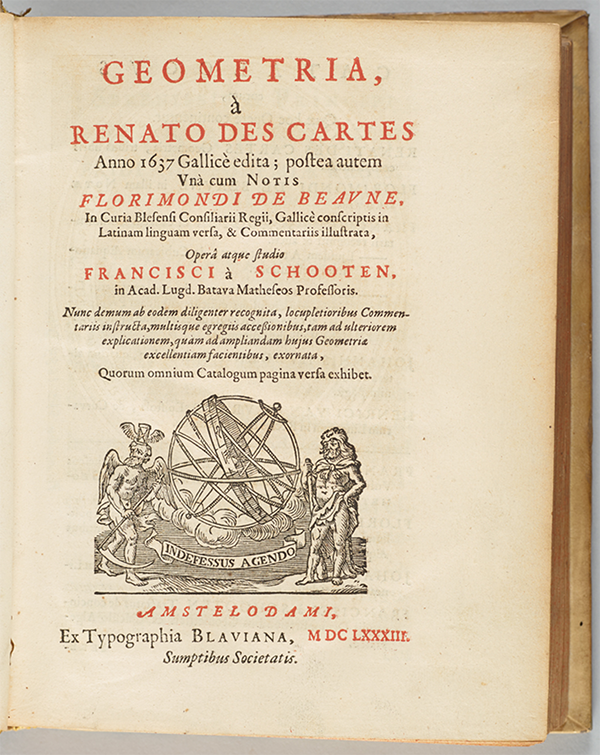
Descartes, for whom no influence by Viète has been determined, famously published his La Géométrie, as an appendix to his Discours de la méthode in 1637.
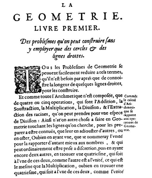
The real impact of the work coming with the publication of the second, expanded, Latin edition by Frans van Schooten Jr (1615–1660) in 1649. You can search La Géométrie, as much as you want but you won’t find any trace of an orthogonal, Cartesian coordinate system, as used today. This was first introduced by Frans van Schooten in the Latin edition.
The resemblance between these coordinates and the lines of latitude and longitude which Mercator drew on his maps is indicative. It was in this way that Mercator, and to a certain extent Viète, enabled the northern Renaissance to lay the foundations for our present world view. It was they who sought to devise a coordinated representation of our modern physical world in geography, and pointed the way to our modern theoretical world of multidimensional mathematics.
Well at least Strathern recognises that a longitude and latitude grid as used by Mercator is an orthogonal, coordinate system but as is fairly clear from this final paragraph he definitely suffers from the illusion that Mercator invented the orthogonal longitude and latitude grid, which is simply historical hogwash.
If someone was intending to write an essay about Gerard Mercator, one might think that they would first acquaint themselves with an extensive knowledge of cartography and its history, in which Mercator played a highly significant role. Paul Strathern apparently didn’t feel this was necessary and obviously didn’t bother, the result is a steaming heap of bovine manure masquerading as history.