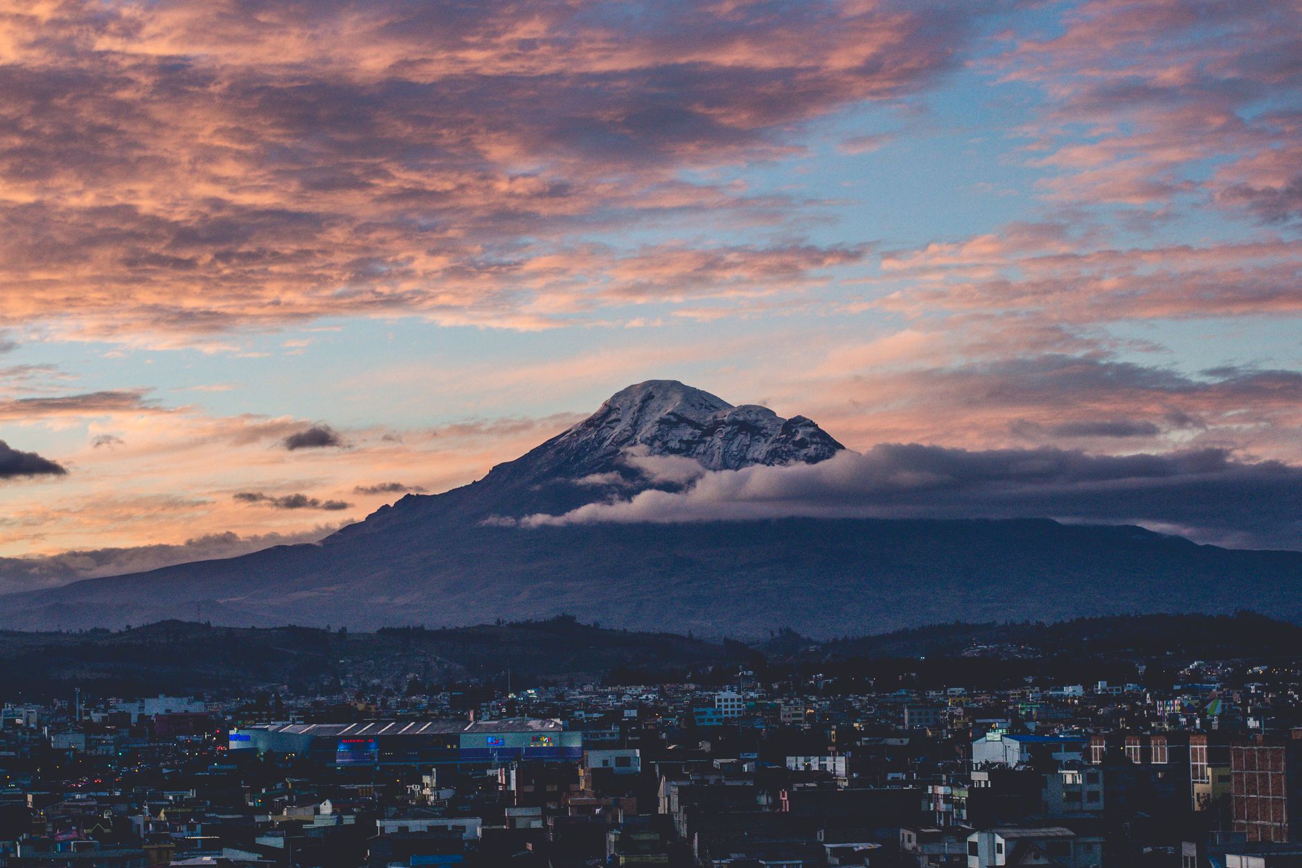
Mount Everest, Mauna Kea, and Chimborazo can each be referred to as the tallest mountain on Earth, but only when the measurement criteria are specified. Everest boasts the highest peak above the average sea level. Mauna Kea extends further from its adjacent seafloor to its peak. Chimborazo’s summit is the farthest from the center of the Earth compared to any other surface point.
These do not represent conflicting survey outcomes. They respond to three distinct inquiries regarding a planet that is neither a flawless sphere nor an even surface.
## Everest is tallest above average sea level
China and Nepal collaboratively revealed Everest’s officially recognized snow-surface elevation as [8,848.86 meters above sea level](https://www.fmprc.gov.cn/mfa_eng/gjhdq_665435/2675_665437/2752_663508/2754_663512/202406/t20240607_11411566.html) in 2020. Based on the definitions utilized by maps, surveyors, and mountaineers, Everest retains the title of the world’s tallest mountain.
“Above sea level” may imply a measurement from a clearly visible shoreline. However, it is more nuanced than that. Tides fluctuate, winds accumulate water against shores, currents change, and gravity is not constant. Surveyors require a stable reference surface that can stretch below continents rather than relying on the water level recorded at a specific beach on a particular day.
That reference aligns with the geoid, which serves as a model of the shape that global mean sea level would adopt under the influence of gravity and rotation, discounting the short-term movements of waves and tides. Elevation indicates how far a peak rises above that collectively accepted zero surface, but it does not reflect the mountain’s complete height from a geological foundation or the summit’s distance from the Earth’s core.
The peak itself necessitates a conventional definition. The 8,848.86-meter figure encompasses Everest’s snow cap. Previous Chinese assessments occasionally cited a lesser rock height below the snow. Both measurements could accurately depict different surfaces.
## Mauna Kea is largely submerged
Mauna Kea’s summit on the island of Hawaii measures 4,207.3 meters above sea level, per the [US Geological Survey](https://www.usgs.gov/volcanoes/mauna-kea/science/geology-and-history-mauna-kea). This figure appears modest when compared to Everest, as most of the volcano lies beneath the Pacific Ocean.
From the summit, its slopes drop more than four kilometers to the coastline and continue underwater for approximately six kilometers before reaching the deep ocean floor. According to the agency, Mauna Kea has a total height from base to summit of [almost 10,211 meters](https://www.usgs.gov/faqs/how-big-are-hawaiian-volcanoes?items_per_page=6&page=1&qt-news_science_products=0), or about 33,500 feet.
Utilizing these data, Mauna Kea is roughly 1.36 kilometers taller than Everest from its chosen base. A climber commencing at sea level would not experience that entire ascent, as the first six kilometers are submerged.
There is a significant caveat embedded in the term “base.” Mountains do not possess distinct lower boundaries. A vast shield volcano merges into nearby volcanic material, rests upon oceanic crust, and distorts that crust under its weight. The defined starting point determines the outcome.
The same USGS has indicated that the neighboring Mauna Loa rises about 17 kilometers above the deepest section of the down-bowed seabed beneath it. In terms of that structural definition, Mauna Loa can assert a greater base-to-summit measurement. The commonly recognized Mauna Kea record initiates at the adjacent ocean floor, which is the standard employed by [NOAA’s comparison of the three peaks](https://oceanservice.noaa.gov/facts/highestpoint.html).
Thus, Mauna Kea triumphs in a valuable and widely accepted category, but not every conceivable version of “from the bottom.”
## Chimborazo originates from a broader section of Earth
Chimborazo is a glacier-clad volcano located in Ecuador, with a summit approximately 6,268 meters above sea level. It stands over 2.5 kilometers lower than Everest in terms of elevation. Yet, its placement near the equator provides it with an advantage when height is assessed from the planet’s core.
Earth’s daily rotation and internal configuration cause the planet to be slightly compressed at the poles and broader around the equator. Geodesists characterize this simplified shape as an oblate spheroid instead of a sphere. The WGS 84 reference ellipsoid used for mapping and satellite navigation has an equatorial radius of 6,378.137 kilometers and a polar radius of about 6,356.752 kilometers.
The disparity is roughly 21.4 kilometers, which is considerably larger than the elevation difference between Everest and Chimborazo.
Chimborazo is located approximately one and a half degrees south of the equator, where the underlying reference surface is near its maximum distance from the Earth’s